Antarctica • South Pole
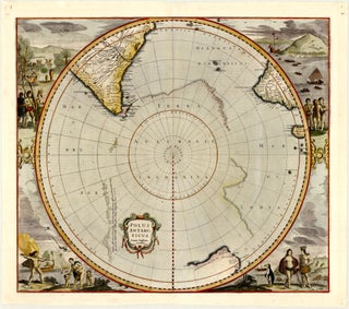
One of the earliest maps of Antarctica
Amsterdam: JANSSON, Jan, c. 1645
49.9 x 43.8 cm / 19.6 x 17.2 in
Description
This c. 1645 Jansson map on a circular south-polar projection was originally drawn by Henricus Hondius II and first published by him in the late 1630s. It is one of the first to focus entirely.....
World
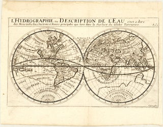
Very rare, reduced derivative of Sanson’s namesake map of the world
Paris [?]: Anonymous, c. 1652
27.6 x 16.3 cm / 10.9 x 6.4 in
Description
This double-hemisphere world map closely resembles, in a smaller version, Nicolas Sanson’s 1652 map of the same name. It shows as creator H. Picart – possibly French artist and engraver Hugues Picart. The map focuses.....
World
First edition of Sanson’s very uncommon map of the world
Paris: MARIETTE (the Elder), Pierre, 1657 (dated)
54.0 x 38.3 cm / 21.3 x 15.1 in
Description
This elegant double-hemisphere map of the world is rather unusual in that it is styled as a map of the ancient world, yet it is reflecting cartographic knowledge accurate for its time.
The.....
North Atlantic Ocean
First edition of Doncker’s unusual chart of the North Atlantic
Amsterdam: DONCKER, Hendrick, c. 1659
54.7 x 43.6 cm / 21.5 x 17.2 in
Description
This is the first state of this uncommon sea chart by Hendrick Doncker, taking in parts of the eastern coastlines of the Americas. Oriented to the east, the chart reaches from present-day eastern Quebec (Nova.....
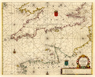
English Channel
Rare chart of the English Channel by Doncker
Amsterdam: DONCKER, Hendrick, 1661 (dated)
53.8 x 42.7 cm / 21.2 x 16.8 in
Description
This 1661 sea chart by Hendrick Doncker focusses on the English Channel, taking in the adjacent coastlines of southern England and northern France. It reaches from southeastern Ireland, southern Wales, and Essex in the north.....
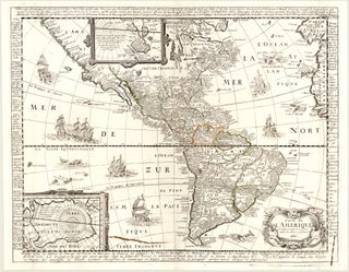
Western Hemisphere • Americas
Very rare Berey map of the Americas
Paris: JAILLOT, Alexis-Hubert [?], 1671 (dated)
51.6 x 40.2 cm / 20.3 x 15.8 in
Description
This is the second state of this very rare, separately issued map of the Americas. It was first published by Nicolas Berey (I?) in Paris, in 1658. Considering that he and his (also engraver-publisher).....
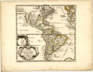
Western Hemisphere • Americas
Scarce 8th state of Du Val’s uncommon map of the Americas
Paris: DU VAL, Pierre, 1676 (dated)
38.5 x 36.8 cm / 15.2 x 14.5 in
Description
This map of the Western Hemisphere by Pierre du Val was published in Paris, in 1676. It was first issued in 1655, then underwent numerous revisions throughout its publication history until 1684, the year.....
World
A rare and unusual map of the world on two separate sheets
Ulm: WAGNER, Matthias, 1687 (dated)
28.7 x 29.3 cm / 11.3 x 11.5 in
Description
This map presents the world across a pair of sheets, with one showing the Western Hemisphere and the other – the Eastern Hemisphere. Each hemisphere is depicted in a frame, with each corner adorned by.....
World
Superb example of the first state of Mortier’s unique map of the world
Amsterdam: MORTIER, Pierre, 1700
47.3 x 40.2 cm / 18.6 x 15.8 in
Description
This is Pierre Mortier’s peculiar world map, drawn on Mercator’s projection. It is unique in its decorative use of four insets at the top. It also features several cartographic myths.
The insets consist, from left to.....
World
Attractive example of Coronelli’s rare world map, published by Nolin
Paris: NOLIN, Jean Baptiste, c. 1700
60.1 x 45.8 cm / 23.7 x 18.0 in
Description
This highly decorative map of the world is the outcome of a close cooperation between Vincenzo Coronelli and Jean Nicolas du Tralage (also known as Sieur de Tillemont), a French geographer and cartographer. Its.....
World
Rare, reduced version of the first chart to show the pattern of magnetic variation
London: [various], c. 1708
48.0 x 19.3 cm / 18.9 x 7.6 in
Description
From 1676 to 1678, English polymath Edmond Halley undertook an expedition to the island of Saint Helena, primarily to carry out astronomical observations. The expedition also yielded the first chart to depict trade winds and monsoons.....
World
Very rare horological map of the world
Nuremberg: WEIGEL (the Elder), Johann Christoph, c. 1708
32.7 x 23.5 cm / 12.9 x 9.3 in
Description
This uncommon German world map by an anonymous cartographer is a very early example of thematic mapping. Its intent is to show time differences around the world, practically making it an early.....
English Channel
Uncommon chart of the English Channel by Van Keulen
Amsterdam: VAN KEULEN, Johannes, c. 1710
57.1 x 49.3 cm / 22.5 x 19.4 in
Description
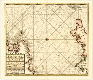
Oriented to the west, this sea chart by Gerard van Keulen focusses on the western end of the English Channel, taking in the adjacent coastlines of southwestern England and northwestern France. It reaches from.....
North Atlantic Ocean
Unusual French map of the North Atlantic
The Hague: DE ROGISSART, Alexandre, 1724-38
54.0 x 40.7 cm / 21.3 x 16.0 in
Description
Applying a conical projection, this map reaches from the Arctic Circle to the equator, taking in parts of the eastern coastlines of the Americas as well as Western Europe and northwestern Africa.
Across the.....
World
Ottens’ issue of de l’Isle’s large and important world map
Amsterdam: OTTENS, Reiner & Joshua, c. 1730
59.5 x 45.0 cm / 23.4 x 17.7 in
Description
This decorative double-hemisphere map of the world demonstrates de l’Isle’s scientific approach to mapmaking and his pursuit of accuracy. Compared with other maps of the time, it is sparse on cartographic myths, while.....
World
An attractive chart of the world by one of England’s most prolific mapmakers
London: WOODWARD, T.[homas?] et al. 1744-48
45.7 x 36.5 cm / 18.0 x 14.4 in
Description
This detailed sea chart, drawn on Mercator’s projection, has a strong maritime focus. It features a decorative title cartouche, four compass roses, and numerous rhumb lines. Geographical detail is concentrated along the coastlines, similar.....
World
First edition of Janvier’s decorative map of the world
Paris: LATTRÉ, Jean, 1762 (dated)
45.3 x 30.4 cm / 17.8 x 12.0 in
Description
This beautiful double-hemisphere world map is from the first edition of Jean Lattré’s Atlas Moderne. It features an elaborate, large rococo-style title cartouche, with each hemisphere surmounted by its own title – Hemisphere Occidental and.....
World
Scarce and splendid French double-hemisphere map of the world
Paris: BOURGOIN, Pierre, c. 1766
44.3 x 31.4 cm / 17.4 x 12.4 in
Description
This beautiful world map was engraved and published by Pierre Bourgoin. It features an elegant rococo-style title cartouche, with each hemisphere surmounted by a banner with its title – Hemisphere Occidental and Hemisphere Oriental.
The.....
World
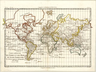
A fine example of one of Bonne’s maps of the world, featuring the Hawaiian Islands
Paris: BONNE, Rigobert, 1782 (dated)
31.7 x 21.5 cm / 12.5 x 8.5 in
Description
Drawn on Mercator’s projection, this world map reflects some of the Western civilization’s newly gained geographic knowledge following Captain James Cook’s third Pacific voyage, while still showing some enduring cartographic misconceptions.
Notable features include...
World
Handsome double-hemisphere map of the world, reflecting Cook’s discoveries
Paris [OR] Brussels [?]: Libraires Associés [OR] LE FRANCQ, Benoît [?], 1792 (dated)
28.6 x 14.7 cm / 11.3 x 5.8 in
Description
Created by an unknown cartographer, this world map displays some of the Western civilization’s newly gained geographic knowledge following Captain James Cook’s third Pacific voyage yet also.....
World
A Cold War treasure featuring a "fake" Lufthansa
East Berlin: Abteilung Presse und Werbung der Deutschen Lufthansa, Zentralflughafen Berlin-Schönefeld, 1962 (dated)
54.7 x 37.2 cm / 21.5 x 14.6 in
Description
There is more to this mid-century pictorial world map than meets the eye! A quick, first glance at it shows an airline route network covering the globe.....
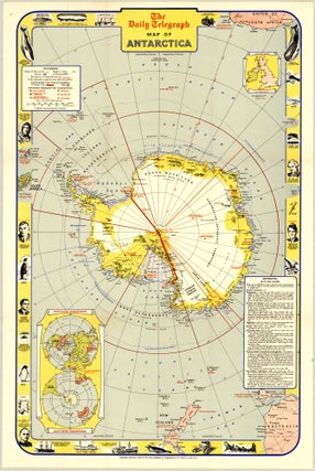
Antarctica • South Pole
Beautiful mid-century pictorial map of Antarctica
London: The Daily Telegraph, 1957
46.5 x 73.0 cm / 18.3 x 28.7 in
Description
This intriguing folding map of Antarctica was published by The Daily Telegraph in 1957 as part of the celebration of the International Geophysical Year and the associated upcoming Commonwealth Trans-Antarctic Expedition.
The International Geophysical Year.....

![Orbis Vetus, et Orbis Veteris Utraque Continens, Terrarum[que] Tractus Arcticus, et Antarcticus....](https://compassantiquemaps.cdn.bibliopolis.com/pictures/16.jpg?width=320&height=427&fit=bounds&auto=webp&v=1779698727)

![Untitled set of 2 maps - Western Hemisphere and Eastern Hemisphere]. Eberhard Werner HAPPEL](https://compassantiquemaps.cdn.bibliopolis.com/pictures/47.jpg?width=320&height=427&fit=bounds&auto=webp&v=1779700494)