
British Isles
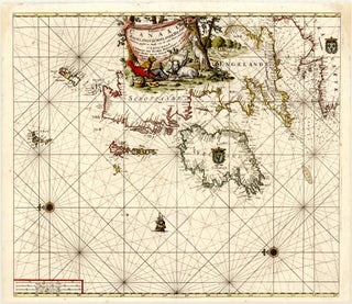
Item 35Paskaart van't Canaal Engelandt Schotlandt en Yrland Naaukeurig opgestelt en dienstig voor die achter Yrland omkomen.
Amsterdam: VAN KEULEN, Johannes, c. 1705
58.5 x 51.1 cm / 23.0 x 20.1 in
Description This is Johannes van Keulen’s second sea chart of the British Isles. It derives from his maritime atlas De nieuwe groote lichtende zee-fakkel, ..., first published in 1681 in Amsterdam. Oriented to the east.....