Southeastern Europe • Balkans
A scarce early map of the Balkans from one of the rarest atlases ever published
Antwerp: CONINX, Arnold, 1593
49.5 x 33.8 cm / 19.5 x 13.3 in
Description
This elegant, detailed 1593 map of Southeastern Europe is from the Speculum orbis terrae, the second edition of Gerard and Cornelis de Jode’s atlas first published in 1578 in Antwerp, then as Speculum orbis terrarum. It.....
Poland
Manesson-Mallet map of Poland with unique provenance
Frankfurt on the Main: ZUNNER, Johann David, c. 1684
11.5 x 14.9 cm / 4.5 x 5.9 in
Description
This map focuses on Poland, depicting the region between the Gulf of Finland, western Russia, Romania, and eastern Germany.
The map is adorned by a drape-style title cartouche, at the bottom.....
Istanbul, Turkey
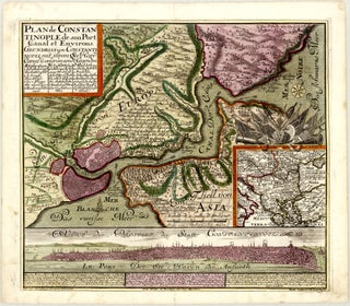
Rare and attractive triple depiction of Istanbul by Seutter
Augsburg: SEUTTER, Matthäus, c. 1740
55.0 x 48.4 cm / 21.7 x 19.1 in
Description
This beautiful c. 1740 German copper print illustrates Istanbul on one sheet in three different ways – on a local combined map and city plan with partial bird’s-eye view, on a regional map, and through.....
Ukraine • Russia
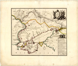
Rare and historically important map of Ukraine and southwestern Russia
Amsterdam: SCHENK (the Younger), Pieter, c. 1745
47.1 x 40.8 cm / 18.5 x 16.1 in
Description
This map of southern Ukraine and southwestern Russia by Hendrik de Leth shows the region during the Russo-Turkish War of 1735-1739 – one of no less than three such conflicts in the 18th.....
Northern, Central, Eastern Asia • Russia
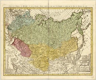
Highly detailed Güssefeld map of the Russian Empire and Tartary
Nuremberg: Homann Heirs, 1786 (dated)
60.5 x 46.6 cm / 23.8 x 18.3 in
Description
Please enquire.
Condition
Very good.
Issued folding. Beautiful early colouring. Crease along centrefold. Light shade along top centrefold, from adhesive used to attach backstrap. A small spot in left blank margin.

![Title on verso] Tractus Danubii, Tabula II. Gerard and Cornelis DE JODE](https://compassantiquemaps.cdn.bibliopolis.com/pictures/32.jpg?width=320&height=427&fit=bounds&auto=webp&v=1779699828)