
Caribbean
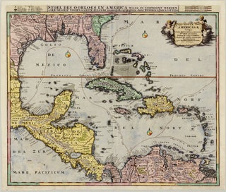
Item 83Insulae Americanae Nempe: Cuba. Hispaniola. Iamaica. Pto Rico. Lucania. Antillae vulgo Caribae. Barlo-et sotto-vento. etc.
Amsterdam: OTTENS, Reiner & Joshua, c. 1740
58.1 x 47.9 cm / 22.9 x 18.9 in
Description As per its Latin title, this beautiful map focuses on the Caribbean, also taking in neighbouring islands and covering the Spanish Main – stretching from Florida through present-day Mexico and Central America to.....