
Carolinas, United States
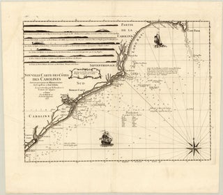
Item 67Nouvelle Carte des Côtes des Carolines Septentrionales et Meridionales du Cap Fear a Sud Edisto[.] Levees et Sondees par N. Pocock en 1770. Traduites de l'Anglois.
Paris: LE ROUGE, Georges-Louis, 1778 (dated)
52.5 x 39.8 cm / 20.7 x 15.7 in
Description This important chart of the Carolina coastline from the time of the American Revolutionary War was created and published by Georges-Louis le Rouge in 1778. It is based on a chart by English sailor.....