Holy Land

Item 127Tabula Terre Sanctae.
Lyon: TRECHSEL, Melchior & Gaspar, 1535
42.0 x 24.7 cm / 16.5 x 9.7 in
Description Please enquire. Condition Fine. Printed on watermarked paper, folding. Uncoloured. Light shine-through.

Lyon: TRECHSEL, Melchior & Gaspar, 1535
42.0 x 24.7 cm / 16.5 x 9.7 in
Description Please enquire. Condition Fine. Printed on watermarked paper, folding. Uncoloured. Light shine-through.
![Untitled - Southeast Asia]. Anonymous](https://compassantiquemaps.cdn.bibliopolis.com/pictures/31.jpg?width=320&height=427&fit=bounds&auto=webp&v=1779699778)
Amsterdam: JANSSON, Jan, 1621/46
45.0 x 31.9 cm / 17.7 x 12.6 in
Description This sea chart is an extended version of a chart by Theodore de Bry, first published in Part XI of his Les grands voyages, in Oppenheim (Latin edition) and Frankfurt on the Main (German edition) in.....

Paris: TAVERNIER, Jean-Baptiste, 1679
77.2 x 51.9 cm / 30.4 x 20.4 in
Description This early landmark map of Japan appeared in the present large format only in the 1679 first edition of Jean-Baptiste Tavernier’s Recueil de plusieurs relations et traitez singuliers et curieux. The publication was an addition to.....

Frankfurt on the Main: JUNG, Johann Adam, c. 1719
10.1 x 14.3 cm / 4.0 x 5.6 in
Description This map focuses on Arabia, depicting, among other, Medine [i.e. Medina], Mecque [i.e. Mecca], Mascalat [i.e. Muscat], and Aden. The title cartouche takes the form of two dragons, entwined by their.....
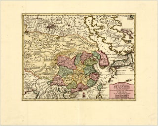
Amsterdam: TIRION, Isaak, c. 1740
32.7 x 25.1 cm / 12.9 x 9.9 in
Description This map of China, Korea, and Japan is from a French edition of Isaak Tirion’s Nieuwe Hand-Atlas (New hand atlas), published in Amsterdam c. 1740. The map covers a broad region extending from Tibet and.....
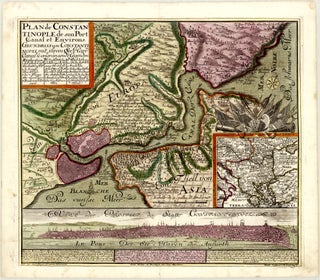
Augsburg: SEUTTER, Matthäus, c. 1740
55.0 x 48.4 cm / 21.7 x 19.1 in
Description This beautiful c. 1740 German copper print illustrates Istanbul on one sheet in three different ways – on a local combined map and city plan with partial bird’s-eye view, on a regional map, and through.....
Amsterdam: TIRION, Isaak, c. 1744
Please enquire.
Description This map of China, Korea, and Japan is from an Italian edition of Isaak Tirion’s Nieuwe Hand-Atlas (New hand atlas), published in Amsterdam c. 1744. The map covers a broad region extending from Tibet and India in the west to Japan in.....

Lyon: DAUDET, Jean Louis, 1748 (dated)
69.9 x 48.1 cm / 27.5 x 18.9 in
Description Please enquire. Condition Good. A sharp impression on watermarked paper, issued folding. Early colouring in outline. Toned throughout, with some dust soiling, all partially stronger in margins as well as in panel text at.....
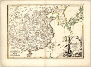
Paris: LATTRÉ, Jean, c. 1783
44.9 x 31.5 cm / 17.7 x 12.4 in
Description Please enquire. Condition Fine. Printed on watermarked paper, folding. Early colouring in outline. A few faint spots, contained to margins.
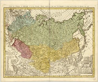
Nuremberg: Homann Heirs, 1786 (dated)
60.5 x 46.6 cm / 23.8 x 18.3 in
Description Please enquire. Condition Very good. Issued folding. Beautiful early colouring. Crease along centrefold. Light shade along top centrefold, from adhesive used to attach backstrap. A small spot in left blank margin.

Amsterdam: ELWE, Jan Barend, 1792 (dated)
58.2 x 47.0 cm / 22.9 x 18.5 in
Description This beautiful, contemporary-coloured map of Asia was published by Jan Barend Elwe in 1792 in Amsterdam. The map is richly detailed, with countless topographical features and placenames throughout. Relief and vegetation are rendered pictorially.....
London: LAURIE, Robert & WHITTLE, James, 1799 (dated)
124.4 x 106.5 cm / 49.0 x 41.9 in
Please enquire.
Paris: DELAMARCHE, Charles-François, 1806 (dated)
28.4 x 24.4 cm / 11.2 x 9.6 in
Description This is a Delamarche reissue of a map of southern and eastern Asia by De Vaugondy, first published almost 50 years earlier. Engraved by Dussy. Condition Very good. Issued folding. Coloured in outline. Minor, inconspicuous.....
Paris: Chez Basset / Maison Basset, 1825 (dated)
117.5 x 87.4 cm / 46.3 x 34.4 in
Please enquire.

Amsterdam: ELWE, Jan Barend, 1792 (dated)
56.3 x 47.6 cm / 22.2 x 18.7 in
Description This beautiful, contemporary-coloured map of the Middle East features the Arabian Peninsula and Persia prominently. It presents the region from the Black and Caspian seas and present-day Georgia, Armenia, and Azerbaijan in the north.....